
How to get to Rainbow Bridge by boat on Lake Powell
Rainbow Bridge sits ~50 miles up Lake Powell — a full-day, 100-mile round trip with no fuel midway. Distances, the low-water hike, and the rules to know.
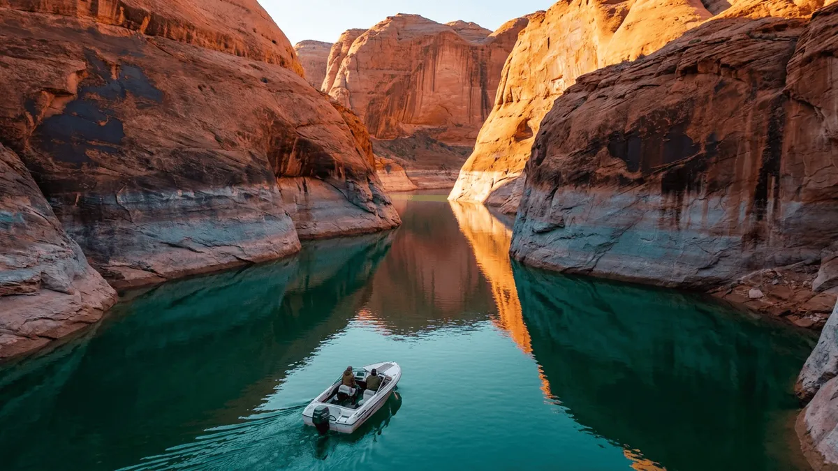
Quick answer
Rainbow Bridge is about 50 miles up Lake Powell from Wahweap — roughly a seven-hour, 100-mile round trip by boat with no fuel in the middle since Dangling Rope closed. The guided Wahweap tour is suspended for low water. At today’s levels the dock doesn’t reach land, so you beach the boat and hike about 1.2 miles each way to the viewing area.
Rainbow Bridge is the headline run on Lake Powell — a 290-foot sandstone arch tucked up a side canyon, one of the largest natural bridges in the world, and reachable by almost no one except boaters. There’s no road to it. The trip is long, there’s no fuel out there anymore, and low water has changed how you finish the last mile on foot. Here’s what the run takes in 2026.
| From | Distance to Rainbow Bridge | Round-trip time | Fuel |
|---|---|---|---|
| Wahweap | ~50 miles (each way) | ~7 hours (NPS estimate) | Top off first; none mid-lake |
| Antelope Point | ~45 miles (each way) | ~6 hours (charter) | Top off first; none mid-lake |
| Bullfrog / Halls Crossing | Comparable run from the north | Full day | Last fuel is the marina |
How far is Rainbow Bridge by boat, and how long does it take?
From Wahweap, Rainbow Bridge is about 50 miles up the lake, and the National Park Service pegs the round trip at roughly seven hours — about three hours of running each way, plus an hour at the monument, with no stops. Treat that as a full-day commitment, not a side trip. Antelope Point sits a few miles closer to the main channel, so a charter from there runs a bit shorter, closer to six hours. Bullfrog and Halls Crossing boaters make a comparable run from the north.
You run the main channel to the mouth of Forbidding Canyon, turn in, and follow it up the Aztec Creek arm to the bridge. The channel is marked by red and green buoys numbered roughly by the mile from Glen Canyon Dam; past the canyon mouth the marked water ends and you idle the tightening arm. On the wide open reaches between marinas, wind is the variable that blows up your timeline — a stiff afternoon breeze builds real waves and can add an hour to the return. Pick a low-wind day and start early.
The distance guide has the leg-by-leg mileage, and the route recommendations lay out the channel line to Forbidding Canyon.
Is there fuel on the way to Rainbow Bridge?
No — and this is the single fact that reshapes the trip. Dangling Rope Marina, the mid-lake fuel and pump-out stop about 15 miles below Rainbow Bridge, is permanently closed. Park officials called the closure “unavoidable” after low water, failed water wells and storm damage made it impossible to run, per ABC4. Nothing has replaced it. There is now no fuel between the south marinas and the bridge.
That turns a Wahweap-or-Antelope-Point run into a round trip near 100 miles with nowhere to refuel in the middle. Top off at the marina before you leave, know your boat’s gallons-per-hour at cruise, and carry a reserve for the idling, the maneuvering in the canyon, and a headwind home. Houseboats burn hard at speed and need the most careful math of all — the fuel planning guide walks the range calculation, and the Dangling Rope Marina page covers what its closure changed. If you’re still deciding what to take, the houseboat rental guide weighs a slow houseboat against a faster day boat for exactly this kind of long haul.
Why doesn’t the dock reach land, and how far is the hike?
At the low water of 2026, the Rainbow Bridge courtesy dock floats offshore and no longer connects to the trail. The Park Service is blunt about it: the floating docks, walkways and restrooms don’t currently reach the Rainbow Bridge trail, and visitors either leave the boat at the dock and swim over or beach it at the sandy canyon edge and walk through the muck — “at your own risk.” From the shoreline it’s about a 1.2-mile hike one way to the viewing area, roughly two miles round trip.
The walk itself is gentle and follows the canyon floor, with two shade shelters for a rest, per the NPS hiking page. The catch is the transition zone between boat and trail: saturated sand, sticky mud and slick rock that shifts with the shoreline. Wear real shoes, not flip-flops, and carry water and sun protection — the canyon runs hot and there’s no shade for the first stretch. The dock only reattaches to the trail once the lake climbs back above about 3,550 feet; for the current elevation and forecast, check lakepowellwaterlevel.com. Until then, budget for the longer walk and treat the mud crossing as part of the hike.
Is the guided Rainbow Bridge boat tour still running?
Not out of Wahweap. Lake Powell Resorts & Marinas lists the Rainbow Bridge boat tour as “currently unavailable until further notice,” and the reason is the same low water that stranded the dock — the tour would now dump guests into a two-mile round-trip walk the big passenger boats were never meant to support. There’s no announced restart date, so plan as if it won’t run this season.
The guided option that remains is a custom charter through Antelope Point Marina, which can arrange a roughly six-hour Rainbow Bridge trip with a guide service. Everyone else makes the run in a private or rented boat, which is how most Rainbow Bridge visitors reach it now anyway. Rental boats come out of Wahweap, Antelope Point and Bullfrog. Whichever way you go, the on-water and cultural rules below apply the same.
Can you hike to Rainbow Bridge instead of boating?
Yes, but it’s a serious backcountry trip, not a walk-up. Two trails cross the Navajo Nation around Navajo Mountain and end at the bridge: the South Route at about 14 miles each way, and the tougher North Route at roughly 19 miles with about 3,500 feet of climbing, per NPS and trip accounts of the North Route. Both are remote, dry and best done as multi-day hikes in spring, when the high ground is clear of snow and not yet baking.
Both routes cross Navajo Tribal land the entire way, so they require an advance backcountry permit from Navajo Nation Parks & Recreation — NPS doesn’t manage or waive it. Even the short trail segment past the boundary fence on the east side of the bridge needs a Navajo permit. Some hardy trips combine the two modes: hike in one way and catch a boat out, or get shuttled to the bridge and paddle back. For a normal visitor with a boat, though, the water route is the one that makes sense.
What are the rules and the cultural protocol at the bridge?
Rainbow Bridge is sacred to the Navajo, Hopi and other nations, and that comes with one request that matters more than any regulation: the Park Service asks visitors not to approach or walk under the span. It’s voluntary — not a fine-backed rule — but treat it as binding. The maintained trail ends at an observation area set back from the arch, which is where you stop, photograph, and leave the bridge itself alone. Keep voices down; the narrow canyon carries sound.
The ordinary Glen Canyon rules apply on the water. Entry is $30 per vehicle for a week or $55 for an annual pass, plus the vessel fee, per the NPS fee page. Idle near the dock and in the tight canyon — a wake in confined water rocks boats off their lines and slaps the shore. Clean, drain and dry your boat when you leave to stop quagga mussels hitchhiking to the next lake; the Park Service requires it. And because most of the run past the marinas has no cell service, download your maps, mark your fuel stops and check the forecast before you launch — the weather safety guide covers the wind rules, and our guide to GPS and cell service explains why your position keeps working offline even when the map won’t load.
Rainbow Bridge is the trip that pulls the whole side-canyon map together — the longest, most committing run to the most famous arch on the lake. Plan the fuel, respect the bridge, and give yourself the whole day.
Key takeaways
- Rainbow Bridge is about 50 miles up-lake from Wahweap — a ~7-hour, ~100-mile round trip, and a full day whichever marina you leave from.
- There’s no fuel on the way since Dangling Rope closed; top off at the marina and carry a reserve for the whole round trip.
- At 2026’s low water the dock doesn’t reach land — beach the boat and hike about 1.2 miles each way, in real shoes, with water.
- The guided Wahweap tour is suspended; a private/rented boat or an Antelope Point charter is how you get there now.
- The bridge is sacred — the Park Service asks you not to walk under it; view it from the observation area and idle near the dock.
Frequently asked questions
How do you get to Rainbow Bridge?
Two ways: by boat up Lake Powell, or on foot across the Navajo Nation. There is no road. Almost everyone comes by water — it’s about 50 miles up-lake from Wahweap, a full-day round trip. The land alternative is a 14-mile hike (the South Route) or a 19-mile one (the North Route) around Navajo Mountain, and both need an advance backcountry permit from Navajo Nation Parks & Recreation. For a day visitor, the boat is the only practical option.
Is the Rainbow Bridge boat tour running in 2026?
No. The scheduled Rainbow Bridge tour out of Wahweap is suspended — Lake Powell Resorts & Marinas lists it as “currently unavailable until further notice” because low water now forces a roughly two-mile round-trip walk from the dock to the bridge. There’s no announced restart date. Your remaining guided option is a custom charter arranged through Antelope Point Marina; otherwise you make the run in your own or a rented boat.
How far is the hike from the boat to Rainbow Bridge?
About 1.2 miles one way at current low water, so roughly two miles round trip. The courtesy dock no longer reaches dry land, so you beach the boat at the sandy canyon edge and walk in from there — the National Park Service says to cross the mud “at your own risk.” The trail is gentle with two shade shelters along the way. When the lake is higher the walk shrinks to about a quarter mile, but that isn’t the case in 2026.
How long does the boat trip to Rainbow Bridge take?
Plan a full day. The National Park Service puts the round trip from Wahweap at about seven hours — roughly three hours of running each way plus an hour at the monument, with no stops. Add time for the low-water hike, photos, and any wind that slows you on the open channel. A charter out of Antelope Point runs about six hours. This is not a quick side trip; it’s the main event of the day.
Is there fuel on the way to Rainbow Bridge?
No. Dangling Rope Marina, the old mid-lake fuel stop about 15 miles below Rainbow Bridge, is permanently closed. That leaves no fuel between the south marinas and the bridge, turning a Wahweap run into a round trip near 100 miles with nowhere to refuel in the middle. Top off at Wahweap or Antelope Point before you leave, know your boat’s range, and carry a reserve. Bullfrog and Halls Crossing boaters fuel up at the marina for the same reason.
Can you walk under Rainbow Bridge?
You can, but the Park Service asks you not to. Rainbow Bridge is sacred to the Navajo, Hopi and other nations, and NPS requests — voluntarily, not as a fine-backed rule — that visitors not approach or walk under the span. The maintained trail ends at an observation area short of the bridge, and going past the boundary fence on the east side requires a Navajo Nation permit. View it from the observation area and leave the arch alone.
When is the best time to visit Rainbow Bridge by boat?
Spring and fall. April through May and September into October give you calm mornings, moderate heat and lighter traffic on the long open-channel run. Summer works but the canyon bakes — ambient temperatures top 100°F, and the 1.2-mile low-water hike in that heat is taxing if you’re not ready for it. Winter turns cold and quiet. Whatever the season, pick a low-wind day; the wide reaches of the main channel build real waves.
Plan the Rainbow Bridge run before you lose signal
The Navigator app maps the route up Forbidding Canyon with offline waypoints, fuel stops and Rainbow Bridge marked — so your position keeps working the whole 100-mile round trip past the last cell bar.