
Lake Powell canyons: the side canyons worth boating to
Lake Powell has roughly 96 major side canyons, from Rainbow Bridge to slots you swim through. Which ones to run, from which marina, and how to boat in.
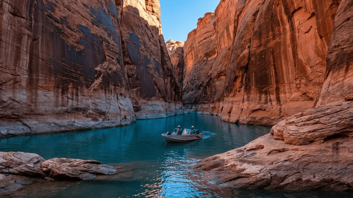
Quick answer
Lake Powell has roughly 96 major side canyons. The ones worth boating to sort into two groups: easy day trips near the south marinas — Antelope, Navajo, Labyrinth and West Canyon — and long runs to Rainbow Bridge (about 50 miles up) and remote stops like Reflection Canyon at buoy 57. Big boats reach the wide lower canyons; slots need a kayak and a willingness to get wet.
The main channel is the highway. The side canyons are the reason you came. Get off the buoy line and nose into one of these flooded gorges and the lake stops being a big open reservoir and turns into a maze of sandstone corridors, sandy beaches and slots so narrow you touch both walls. Here are the canyons worth the fuel, sorted by how far you have to run for them.
| Canyon | Known for | Nearest marina | Boat size | Rough distance |
|---|---|---|---|---|
| Antelope Canyon (lake side) | Orange slot walls, short scenic run | Antelope Point | Full-size in lower reach | Day trip |
| Navajo Canyon | Longest side canyon, ~600-ft walls | Antelope Point | Full-size most of 15 mi | Day trip |
| Labyrinth Canyon | Sandy slot, swimming beach at the end | Wahweap | Small boat / kayak in the slot | Day trip (Padre Bay) |
| West Canyon | Stream, waterfalls, pools you swim | Wahweap | Full-size lower, hike the rest | ~25 mi uplake |
| Rainbow Bridge (Forbidding Canyon) | Largest natural bridge on the lake | Wahweap / Bullfrog / Halls | Full-size to the courtesy dock | ~50 mi (each way) |
| Reflection Canyon | Serpentine meanders, remote | None close | Any, plan fuel hard | Main channel, buoy 57 |
How many side canyons does Lake Powell have, and which ones matter?
Boating guides put the count at roughly 96 major side canyons — the flooded tributary gorges branching off the main channel and the big river arms, per Lake Powell Resorts & Marinas. Count the smaller named ones and the total climbs: the Navigator map names 132 side canyons across the lake. You will never see them all, and you don’t need to. A handful get almost all the exploring traffic because they’re either close to a marina or worth a long run.
The lake splits neatly for planning. The south end, near Wahweap and Antelope Point, holds the day-trip canyons — Antelope, Navajo, Labyrinth, West, Face — reachable and back before dark. The middle and far ends hold the committing trips: Rainbow Bridge up Forbidding Canyon, Reflection Canyon at buoy 57, Cha Canyon up the San Juan, and the mid-lake arms off Bullfrog and Halls Crossing. Distance, not difficulty, is what separates them.
Every canyon behaves the same way as you go in. It starts wide and deep where it meets the channel, then narrows and shallows toward the back as silt drops out of the slowing water. So the real question for each one isn’t “can I get there” but “how far in before I’m out of my boat.” The distance guide and route recommendations lay out the legs; this post is about what’s at the end of them.
How do you get to Rainbow Bridge by boat?
Rainbow Bridge is the headline canyon trip, and boat is the way almost everyone reaches it — the alternative is a long hike across the Navajo Nation that requires a tribal permit, per the National Park Service. By water it sits about 50 miles up the lake from Wahweap, Bullfrog or Halls Crossing, at least a four-hour round trip by the Park Service’s own estimate, and usually a full day once you factor in stops. You run the main channel to the mouth of Forbidding Canyon, turn in, and follow it to the arm that connects to Aztec Creek and the bridge.
At the end of navigable water there’s a courtesy dock for short-term tie-up — though as of mid-2026 it doesn’t always reach dry land, and the Park Service tells visitors to approach at their own risk. From the dock a trail leads to a viewing area set back about 200 feet from the span. How long that walk is depends on how far the lake reaches into the canyon that season — the Park Service quotes anywhere from a quarter mile to two miles one way. When the lake is high the dock can sit almost under the bridge; when it’s lower the dock moves down-canyon and the walk gets longer, sometimes over soft sand before you reach the hardened path.
One thing to plan hard around: fuel. The old mid-lake fuel stop at Dangling Rope Marina, about 15 miles below Rainbow Bridge, is closed as of mid-2026. That makes a Rainbow Bridge run from the south marinas a round trip near 100 miles with no fuel in the middle. Top off at Wahweap or Antelope Point, know your range, and carry a reserve — the fuel planning guide has the range math.
Rainbow Bridge is sacred to several Native nations, and the Park Service asks visitors — voluntarily, not as a fine-backed rule — not to approach or walk under the span. View it from the observation area and leave the arch alone. It’s a small courtesy that costs you nothing and honors people who’ve held the place sacred far longer than there’s been a lake here. Docking conditions shift year to year, so check the NPS Rainbow Bridge page before you commit a whole day to the run.
Which canyons are a day trip from Wahweap and Antelope Point?
Four canyons near the south marinas give you a full day of exploring without a long-range fuel calculation, and they cover the whole range — a quick scenic slot, a long deep gorge, and a slot you hike and swim. All of them start close to Antelope Point or Wahweap and none require crossing half the lake.
Antelope Canyon on the lake side is the short, scenic one. This is the flooded arm reached up Antelope Creek, not the famous land slot you tour from Page — that’s a separate place on Navajo Nation land. The lake portion runs orange Navajo Sandstone walls that glow in low sun, and Antelope Point Marina runs one-hour boat tours into it if you don’t have your own boat. Full-size boats handle the lower reach; the tightest upper slot is kayak water.
Navajo Canyon is the long one — the longest side canyon on the lake that isn’t a river arm, winding about 15 miles with walls roughly 600 feet over the water and dark desert-varnish streaks running down the sandstone. Its mouth sits near buoy 10 on the Arizona side, close to Antelope Point. A houseboat or cruiser can idle through much of it; kayaks reach the narrow back, where a flat streambed sometimes has wild horses grazing at the end. Antelope Point runs a two-hour Navajo Canyon boat tour if you’d rather ride than pilot.
Labyrinth Canyon off Padre Bay is the classic slot-by-boat. It winds south into a sandy slot narrow enough to touch both walls with your arms out, walls around 100 feet tall, and it ends at a small sandy beach good for swimming. Big boats stop where it tightens; the slot itself is for kayaks and wading. It’s an easy reach from Wahweap and one of the best introductions to what a Lake Powell slot feels like.
West Canyon, about 25 miles uplake from the dam and best reached from Wahweap, is the adventure of the four. The flooded lower canyon gives way to a stream spread across the floor, small waterfalls you scramble past, and pools you wade or swim through. The lower hike is challenging but not technical — no ropes — though it turns technical if you push far up. Go as far as you like and turn back; save energy for the return.
Face Canyon and the coves off Warm Creek Bay round out the south-lake options for a more casual afternoon. And if you’re working out how to get on the water in the first place, the boat rental guide covers houseboat versus day boat for exactly this kind of trip.
Which canyons are worth the long run?
Past the day-trip range are the canyons you build a whole trip around — remote, low-traffic, and demanding on fuel and planning. These are houseboat-and-multi-day territory, or a hard single push in a fast boat with the range for it. The reward is scenery few boaters bother to reach.
Reflection Canyon at buoy 57 is the one you’ve seen from the air — the tight serpentine meanders that show up in every Southwest photo essay. It sits on the west bank of the main channel opposite the mouth of the San Juan, 9 miles below Hole-in-the-Rock, so reaching it by water is a long run up the channel with no marina anywhere near, per trip accounts from the water. There’s no fuel out there comparable to a marina stop, so this is a fuel-reserve-and-radio trip, not a spur-of-the-moment turn.
Cathedral in the Desert, up the Escalante side, is a hanging alcove and waterfall that appears and disappears with lake conditions — sometimes you idle a kayak right into it, sometimes the back is dry and you walk the last stretch. Because whether the back of these Escalante canyons is reachable depends on how high the lake is sitting, check the current elevation at lakepowellwaterlevel.com before you plan a trip around a specific alcove.
Cha Canyon, about 11 miles up the San Juan arm, is a lush narrow canyon with a small stream, waterfalls and Ute rock art on the walls. It’s a long haul from any marina and worth it for boaters who want history and running water in the same place. Up the middle of the lake, Iceberg, Dungeon, Wetherill and Anasazi Canyons off Bullfrog and Halls Crossing give northern boaters their own set of deep, quiet arms without the extreme distance of the Escalante — good anchoring, high walls, and side hikes from the boat.
Worth naming on its own: Forbidding Canyon is more than the driveway to Rainbow Bridge. The flooded lower canyon takes a full-size boat a good way in, with steep sandstone walls and quiet spots to anchor short of the crowded Rainbow Bridge arm. Push toward Aztec Creek and the terrain gets complex — the classic boater-and-foot route up Aztec Creek and over Redbud Pass mixes water, climbs and drops, which is why most people tie up at the courtesy dock and walk the maintained trail instead. Treat Forbidding Canyon as a scenic stop in its own right, not just the last five minutes before the bridge.
How do you actually boat into a narrow canyon safely?
Getting into a side canyon is mostly about reading the narrowing and respecting it. The main channel is marked by red and green buoys whose numbers approximate miles from Glen Canyon Dam, per the NPS boating page — you follow those to a canyon’s mouth, then leave the marked water behind. Inside, there are no buoys, the depth drops as silt shallows the floor, and submerged rock lurks on the inside of bends. Slow down as the walls close in and let a lookout watch the water ahead.
Idle speed is the rule once a canyon tightens. Narrow slots hold kayakers, swimmers and anchored boats you can’t see around the next bend, and a wake in a confined canyon is both dangerous and rude — it can rock a docked boat off its lines and slap the shoreline where fragile plants or archaeological deposits sit. Big boats should stop at a wide spot where they can turn and anchor, then deploy a kayak or tender for the tight stuff. Don’t try to muscle a houseboat into a slot; you’ll ground it or wedge it.
One south-lake shortcut is worth knowing. Castle Rock Cut is a man-made channel the Park Service carved to link Wahweap Bay directly to the main channel, saving miles on the run toward the Antelope and Navajo Canyon area. It only floats at higher lake stages, so confirm it’s open before you count on it — when it’s dry you go the long way around Antelope Island. Small navigation facts like this are the difference between a relaxed day and a fuel-anxious one, which is why marking your intended route before you launch matters more here than on a lake you can see across.
Most of the lake past the marinas has no cell service — coverage is decent near Bullfrog, Halls Crossing and a few mid-lake coves, and largely gone once you’re behind a canyon wall. Download your maps before you launch, carry a marine radio for real emergencies, and mark your fuel stops and waypoints while you still have a signal. Our guide to GPS and cell service on the lake covers why your position keeps working offline even when the map won’t load, and the navigation hazards guide covers the submerged-rock problem in detail.
What are the rules once you’re in the canyon?
Canyon alcoves and ledges hold real archaeological sites — ancient dwellings, rock art, buried deposits — and the Park Service treats them as fragile and protected. The Glen Canyon compendium flags alcoves and overhangs as sites needing care; the practical rule is simple: look, photograph, leave it exactly as you found it. Don’t climb into ruins, don’t touch rock art, and report obvious damage to a ranger.
Weather is the other rule-maker, and in slots it’s the one that hurts people. A narrow canyon funnels flash-flood runoff from a storm that can be miles away and out of your sight, and water rises fast where there’s nowhere to climb. Check the forecast before you hike a slot and stay out if thunderstorms are anywhere upstream — the weather safety guide has the wind and storm rules for the whole lake. Same day, same canyon, a blue sky overhead is no guarantee about what’s falling upstream.
Two more that keep the lake usable for everyone. Clean, drain and dry your boat when you leave to stop invasive mussels hitchhiking to the next lake — the Park Service requires it. And pack out everything you bring into a canyon; there are no trash cans up a slot, and a beach that stays clean stays worth beaching on. None of this is heavy lifting. It’s the price of a lake this good staying this good.
Deeper guides
Some of these canyons get their own full write-up. Start here:
- How to get to Rainbow Bridge by boat — the 50-mile run, the low-water hike now that the dock doesn’t reach land, fuel planning after Dangling Rope closed, and the cultural protocol at the bridge.
- Lake Powell slot canyons you can reach by boat — the four canyons the Park Service posts wakeless, what Labyrinth is like on foot, why the Antelope Canyon you paddle to isn’t the one from the photographs, and the flash-flood rule.
- Antelope Canyon by boat — the one tour still running, why both Antelope Point ramps are shut to motorboats in 2026, what the guided kayak trips cost, and the two entrance fees at the gates.
- Reflection Canyon by boat — where buoy 57 actually is, taking a boat into the canyon, the half-mile scramble to the overlook, and how it compares to the 15-mile hike from Hole-in-the-Rock Road.
- West Canyon by boat — buoy 25, how far a boat gets up the gorge, the sandy wash that turns into pools and waterfalls, and where to turn around.
- Navajo Canyon by boat — buoy 10, why it is the one big south-lake canyon you can run at speed, where a big boat has to stop, and the Kaibeto Chapter closure that ended the Chaol Falls hike.
- Labyrinth Canyon by boat — the marked buoy off Padre Bay, why the boat has to idle in and stop, the paddle up the flooded slot, and how far the walking goes.
Key takeaways
- Lake Powell has roughly 96 major side canyons (132 named on the Navigator map); a handful near the south marinas get most of the traffic.
- Rainbow Bridge is about 50 miles up Forbidding Canyon — a ~100-mile round trip now that Dangling Rope’s mid-lake fuel is closed, so plan range and don’t walk under the span.
- Day trips from Wahweap and Antelope Point: Antelope and Navajo (easy, scenic), Labyrinth (a slot you swim), West Canyon (a stream you hike).
- Every canyon narrows and shallows toward the back — big boats anchor at the wide part and you finish by kayak or on foot.
- Idle in the tight water, check the forecast before any slot for flash floods, download maps and mark fuel before you lose signal, and leave the archaeology alone.
Frequently asked questions
Can you get to Rainbow Bridge by boat?
Yes — a boat trip up Lake Powell is the main way people reach Rainbow Bridge. It sits about 50 miles by water from Wahweap, Bullfrog or Halls Crossing, up the arm of Forbidding Canyon that connects to Aztec Creek. A courtesy dock marks the end of navigable water, and a trail runs from there to a viewing area, roughly a quarter mile to two miles depending on how far the lake reaches that season. Rainbow Bridge is sacred to several Native nations, and the Park Service asks visitors not to walk under the span.
How many side canyons does Lake Powell have?
Boating guides count roughly 96 major side canyons branching off the main channel and river arms — the flooded tributary gorges that most exploring happens in. Counting the smaller named ones, the total runs higher: the Navigator map names 132 side canyons across the lake. Only a fraction get regular traffic. Antelope, Navajo, Labyrinth, West and the Rainbow Bridge arm see the most boats; the remote arms in the Escalante and San Juan basins see far fewer because of the distance and fuel a round trip demands.
Which Lake Powell canyon is best for a first-timer?
Navajo Canyon and Antelope Canyon are the easiest first canyons, both close to Antelope Point Marina on the south lake. Antelope Point runs one- and two-hour boat tours into them, so you can see them without your own boat. Navajo Canyon is wide and deep enough for a houseboat or cruiser through most of its 15 miles, with sandstone walls about 600 feet over the water. For a proper slot, Labyrinth Canyon off Padre Bay lets you touch both walls at once and ends at a sandy swimming beach.
Can you take a houseboat into the side canyons?
Into the wide lower reaches, yes. Most side canyons start deep and roomy where they meet the main channel, and a houseboat or cruiser can idle a fair way in and anchor. The catch is that canyons narrow and shallow as you go up them — silt drops out and the walls close in — so at some point the slot is too tight and shallow for a big boat. That is where you anchor, drop a kayak or a small tender, and go the rest of the way on the water or on foot.
Do you need a permit or a tour to see the canyons by boat?
No permit is needed to boat the side canyons inside Glen Canyon National Recreation Area — a Park Service entrance fee covers the lake, and you run the canyons on your own. Guided tours are optional: Antelope Point Marina offers them into Antelope and Navajo Canyons if you would rather ride along. The land-based slot tours of Upper and Lower Antelope Canyon are separate — those are on Navajo Nation land, reached by road from Page, and require a Navajo-authorized guide.
Is there fuel on the way to Rainbow Bridge?
Not anymore. Dangling Rope Marina, the old mid-lake fuel stop about 15 miles below Rainbow Bridge, is closed as of mid-2026. That turns a Rainbow Bridge run from the south marinas into a round trip near 100 miles with no fuel between the start and the turnaround. Top off at Wahweap or Antelope Point before you leave, know your boat’s range, and carry a reserve. The app tracks which of the four open marinas have fuel so you plan the legs against real stops.
Are the slot canyons dangerous?
The main hazard is flash flooding. A narrow slot funnels runoff from a storm that may be miles away and out of sight, and water can rise fast in a canyon with nowhere to climb. Check the forecast before you hike a slot, and stay out if thunderstorms are anywhere upstream. Beyond weather, the risks are ordinary desert ones: slick rock, deep pools you have to swim, heat, and no cell signal to call for help. Turn around when the going stops being fun.
Carry every named canyon in your pocket
The Navigator app maps 132 named side canyons, 18 arches and Rainbow Bridge, with offline waypoints and routes that keep working miles past the last cell bar.